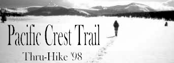
The following article was swiped from Chris Bailey's web site.
It discusses their thru-hiking experience in a big snow year.
(It has been condensed and reformatted)
"Impassable is a State of Mind"
By Chris Bailey
1998 ranked among the three snowiest years on record in the High Sierra during the last 25 years. All that snow had a disruptive effect on 1998 north-bound thru-hikers. This article will provide a little of the flavor of what it was like to thru-hike in a big snow year.
First, some background. Jenelle and Chris set out from Campo on April 26, 1998 and finished their hike at Manning Park on September 22, 1998. They were the 4th and 5th hikers to have made it straight through from Mexico.
During the winter, they had been following the snow reports and had become increasingly concerned. Poring over the data via the internet, they would think, "What the hell is snow water content?" and "Well, 180% doesn’t seem so bad. Maybe it will melt." Adding to their concern was Ray Jardine’s published advice that if the snowpack exceeded 200% of normal (which it was in most of the High Sierra during April 1998), one should postpone their hike till the next year, or - failing that - "that you not start until late May, that you prepare to hike many miles of snowpack in southern and central California, and that beyond the High Sierra you press ahead with a will in order to finish before the early-winter snowstorms hit the North Cascades." However, Chris and Jenelle decided to stick with their April 26th departure date. They didn't want to wait until June and hike southbound, and the idea of hiking home (they lived near Stevens Pass) was appealing.
Ray’s advised that hiking in heavy snow years was really winter mountaineering and beyond the scope of his book. How bad it could be?
Their first evidence came during their flight from Seattle to San Diego on April 25th. The flight path took them directly over the Sierra. They could see Mono Lake and Mt. Whitney. "Is this where we're going to be hiking in a few short weeks? Look at all that snow," they said to each other.
Their Journey Begins
At 9:20 a.m. on April 26th they set out: excited, nervous, anxious, but confident. There was no snow at Campo and not a single patch of snow in the Laguna Mountains, which gave them hope. But they read hiker register entries, dated a couple of weeks before, that mentioned some hikers were on snowshoes.
It wasn’t until they climbed over the shoulder of Combs Peak (map B3 in the S. Calif. guidebook) that they got their first good look at the San Jacintos. "Gulp! Damn, there is a lot of snow there!" They would be there in about 2-3 days.
Unseasonable storms ran them off the Desert Divide into Idyllwild prematurely and after waiting for 3 snowy, rainy days in Idyllwild they made our way back to their bail-off point and continued north. Chris' journal entries for May 8 - 10:
"Finally left Idyllwild today, getting a ride back to Cedar Springs Trail. Jenelle and I spent last night at the State Park Hiker/Biker site in the rain, thunder and hail. The weather still didn't look great but we were really itching to get hiking after three nights in town. All day as we continued north along the Desert Divide, we remained in the clouds. We would occasionally catch glimpses down toward Palm Springs. North of Apache Peak we hit our first steep snow and broke out the ice axes. They were definitely required as one slip would have sent us sliding over rocks, cliffs in some cases, and into trees."
"The majority of the trail today was snow-free but the snowy stretches were tricky. We camped near the head of Andreas Canyon. Our stove sprang a leak in the hose (after only eight days of use) and turned into a fireball. So much for hot food and melting snow for water."
May 9, 1998
"We spent all day today in the snow. Just after leaving our campsite this morning, we were in deep snow after one treacherous traverse on solid ice (refrozen over night). Tracks went everywhere, but we didn't trust any of them because one set were Brian's, who was lost, and another set was Brian and Martina's, who were lost and another was Lynn and Mike's, who were lost, and another set belonged to a ranger, who was lost. We eventually made our way to the vicinity of Deer Springs, but we didn't know exactly where we were. We ended up camping on top of 10 feet of snow (with no stove). It was a long, hellish day during which we would find the trail only about 10 percent of the time and hiked hard all day to cover fewer than ten miles."
May 10, 1998
"After waiting for the sun to soften the snow enough to get decent footing, we made our way across a really sketchy side-hill traverse before finally finding the trail again just below the crest of Fuller Ridge. We were so happy to be on it again, but it soon disappeared under 15 feet of snow on the east side of the ridge. We picked up Brian and Brian and Martina's tracks and followed them to Black Mountain Road below Fuller Ridge campsite. Finally out of the snow, we found a great campsite and made a small fire so we could have a hot meal for the first time in three days."
They continued to have poor weather on and off, all the way to Kennedy Meadows, including an 18-inch snowstorm in the San Bernardino mountains near Mission Creek Trail Camp on May 13th and several other days of really severe weather. The storms were remnants of the El Nino cycle, which didn’t really release its grip on Southern California until mid-June.
The High Sierra
They arrived at Kennedy Meadows on June 10th and spent four nights there waiting for the weather to improve. They made a foray into the Sierra to see what conditions were like. The majority of other thru-hikers had decided to skip this section, going to somewhere in northern California or flip-flopping (hiking south, from Canada). The hand-wringing, nervous speculation, and endless debates about what to do had consumed a lot of thru-hiker energy over the past couple of weeks. It was a nauseating topic.
The weather patterns had settled down by the 13th, and on the 14th, with a new hiking partner, Randy (a section hiker who had started at Tehachapi Pass), they left Kennedy Meadows. They were carrying six days worth of food and their plan was to go as far as Trail Pass and then depending on their progress, continue to Cottonwood Pass or (the best case scenario), continue to Crabtree Meadows, over Trail Crest, and resupply in Lone Pine. Within the first half-day, they met two hikers who said that plan didn’t stand a chance.
They knew of only two hikers who had left Kennedy Meadows heading north ahead of them. One was only going as far as Olancha Pass, where he would hike to Highway 395 and flip-flop. The other hiker was an experienced nordic skier and had skis with him. They felt certain he was out there ahead, which offered them a degree of irrational comfort. He was about a week ahead. (They later learned that he had only traveled about two days before deciding that solo-traveling was not a good idea and flip-flopped).
Before setting out from Kennedy Meadows, they contacted a backcountry ranger at the Lone Pine ranger station. The ranger informed them that there was 100% snow coverage in the high country, but that the snow was "bomber," (i.e., in good condition for traveling). Avalanche danger) was their major concern. They knew they'd struggle (post-hole) badly if the snow was unconsolidated. The ranger’s information turned out to be quite accurate. While the PCTA (and many, many others) were telling hikers that the Sierras were still impassable, they found the hiking strenuous and slow, but quite doable. An excerpt from Chris' journal describes the conditions from Kennedy Meadows to Kearsarge Pass:
"We encountered out first patchy snow at around 9,000 feet, on June 14th, the day we left Kennedy Meadows. The next morning, traversing around Olancha Peak, we walked on patchy to mostly continuous snow for a few hours (at 9-10,000 feet) and had more of the same north of Ash Meadow that afternoon. The following day, we found the same snowpack composition as the day before as we approached Trail Pass and Cottonwood Pass, with solid snow on north and east exposures above 9,000 feet, especially in heavy timber. This pattern continued all the way past Crabtree Meadows to just south of Bighorn Plateau, where the snowpack became pervasive. In all this distance the snow was of a uniform nature: consolidated enough to hike bare-booted, with only occasional post-holing around "warming" objects like rocks and logs. We encountered no sun-cupping yet either, until the north side of Forester Pass in the Bubbs Creek drainage. One nice thing about this southern section was that the southern and western exposures below 10,000’ were often melted out almost completely, so many of our climbs were on bare switchbacks, while our descents (since we’re headed north) were on snow. One disadvantage of spring-like snow is that, especially in timber, the snow falls and drifts to irregular depths, leaving us to climb and descend over miles of one to six foot hummocks – exhausting."
"Forester Pass, our first major obstacle and the highest point on the PCT, had worried us for a couple of days. When we first glimpsed it from a distance, it made us cringe. We hadn’t seen any of the advice posted on our website’s guest book about Forester and had forgotten about Jardine’s recommendation of a possible alternate pass. When we got close enough to see the six to eight foot cornice at the top, the steep couloir, the avalanche debris, and the snow-plastered switchbacks blasted out of the steep rock face, we decided we weren’t going to risk it, though we weren’t sure how to proceed. As we ate lunch and stared at this problem, the pass just a short distance to the east of Forester (and west of Junction Peak), started to seem like an option, though we only had the topo map to indicate what the north side might be like. The pass had a bare talus slope for the last 100 feet and no cornice and didn’t seem unbearably steep, so we decided to give it a whirl. The snow was almost perfect for us to bare-boot up (our only option as we don't have crampons with us and have found little real need for them) protecting ourselves from a fall by self-belaying with our ice-axes. The north side of the pass was steep, but soft and easy to descend."
"The snow in the vicinity north of Forester was pretty rotten in the late afternoon, the worst post-holing through this whole section. Otherwise, the snow conditions the rest of the way to Red’s Meadow became slightly better consolidated, vastly more sun-cupped (in meadows and open stands of timber) and deeper north of Silver Pass (we found snow almost all the way down to Red’s Meadow Resort)."
On that first leg from Kennedy Meadows they exceed expectations and made it all the way to the Kearsarge Pass cut-off, where they headed out to the Onion Valley trailhead, resupplying in Lone Pine (where they had sent their drift box). Unfortunately, the Onion Valley road had just opened and had very little traffic on it. They had to walk 8 (of 15) miles down the road before catching a ride into Independence.
After a couple of days rest in Lone Pine, they decided to continue north along the PCT, rather than flip-flopping. They made an 8-day leg to Red’s Meadow, where they hitched out to Mammoth Lakes for more rest and another resupply. Chris' journal entries for the passes north of Kearsarge:
"As for the rest of the passes: Glen Pass was steep on both sides, but we took a line to the right, following some skiers' steps and topped out through a band of rocks. It was a pretty easy pass, really, as it wasn’t very exposed. The north side had some pretty rotten snow and a few cliffs to descend around."
"Pinchot was quite easy as well. We took a line to the right making first tracks. The back side was no problem."
"Mather Pass was terrifying. The whole pass was corniced, except for one tiny spot above the pass on the left through the rocks. We traversed steeply up the left side, partially exposed to cornices above, crawled through one rock band, climbed steeply up very rotten snow to the next rock band and continued on mixed rock and snow, following (roughly) a skier’s steps over steep rock – quite a challenge! At one point while leading, I sank in to rotten snow with both feet, up to my waist. I was very off-balance (tipping backward on a very steep section) and couldn’t get a purchase on anything with my ice axe (the snow was sno-cone consistency about one foot deep on top of rock). My feet were stuck and I had to get Jenelle to dig them out from behind."
"Muir, Selden and Silver Passes were very easy and straightforward. In all, the snow has been hard work and has made route finding slow and tedious at times. We saw the trail only briefly, except in the valley bottoms. Patience is the key."
"We’ve heard there’ve been a few deaths in whitewater accidents from the high run-off so maybe a few words about stream-crossings are in order. We’ve actually had little difficulty with them. A little scouting for a good spot or log goes a long way. The one that sounded the scariest from the guidebook description, Silver Pass Lake Creek ("a hair-raising stream-crossing at the head of a fatally high cascade") was mostly just noisy, but not difficult."
The snowy trail continued in earnest after Red’s Meadow and the snow level actually dropped the further north they went in the Sierras. While there was little snow on the ground in Tuolumne Meadows, there was still plenty in the Yosemite backcountry and all the way to Sonora Pass. Their worst river fords came between Tuolumne Meadows and Falls Creek, where they had several deep, chest-high crossings. A couple of the hikers, both ahead of and behind them, reported having to inadvertently swim on one or two of the crossings. Thankfully, they were able to scout for logs on a few of these crossings. A few times they had to bushwhack along the streams some distance, crossing miles upstream, where it was safer. By this time they became comfortable with not having a trail to follow. They had experienced little exposed trail over most of the High Sierra.
Their last long stretch of snow wasn’t until shortly before Belden (map M10 in the Calif. guidebook) at approximately 6,800 feet, though they had encountered drifts and snowfields on and off all the way through the Marble Mountain Wilderness in northern California.
Despite all the mental stress and hard work, the snow-covered Sierras were beautiful, vast and awe-inspiring. The physical hardships, the exhaustion, and the frustrations of constant route-finding, were rewarded by solitude, views that few thru-hikers see, and by the reassuring knowledge that they were still heading north to Canada. They wouldn’t trade the experience, and suggest that future thru-hikers (with adequate skills) consider taking the PCT on its own terms, even when conditions are difficult. Not that there’s any "right," "better," or "best" way to hike the trail, but there is perhaps a little value in continuity and accepting the challenges of the trail as you find them.
Chris and Jenelle reside in Leavenworth, Washington, where they work for the Forest Service. You can read more of their journals and view other information about their hike at their website.